Search results
From Chalo Chatu, Zambia online encyclopedia
Page title matches
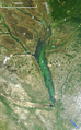
- | name = Lower Zambezi National Park | photo = Lower Zambezi, Zambia (2518067857).jpg3 KB (495 words) - 06:53, 27 February 2018
Page text matches
- |name = National Parks of Zambia |title = [[List of national parks of Zambia|National Parks of Zambia]]1 KB (144 words) - 06:40, 18 October 2018
- ...re free to roam across the whole area. The attraction of the Lower Zambezi park and its surrounding GMA is its remote location. {{TFAFULL|Lower Zambezi National Park}}719 bytes (113 words) - 09:12, 1 March 2018
- .... However, next to the latter on the southern bank is the Zambezi National Park, {{TFAFULL|Victoria Falls}}826 bytes (114 words) - 11:38, 16 February 2017
- .... However, next to the latter on the southern bank is the Zambezi National Park, {{TFAFULL|Victoria Falls}}826 bytes (114 words) - 12:36, 19 February 2018
- ...e lake or river, running from the Batoka Gorge roughly 800 km to the lower Zambezi, and facing each other about 50 to 100 km apart, closer in the west and ope ...a point north of Siavonga going east through the [[Lower Zambezi National Park]] to the [[Luangwa River ]]. Along this section the bottom of the valley is2 KB (268 words) - 06:24, 9 July 2016
- ...is a national monument, forest reserve and Important Bird Area. {{TFAFULL|Zambezi River}} * ''[[Mosi-oa-Tunya National Park|Mosi-oa-Tunya Park]]''806 bytes (112 words) - 15:41, 5 January 2017
- ...is a national monument, forest reserve and Important Bird Area. {{TFAFULL|Zambezi River}} * ''[[Mosi-oa-Tunya National Park|Mosi-oa-Tunya Park]]''806 bytes (112 words) - 08:52, 12 December 2017
- ...lls National Park on the Zimbabwean side. {{TFAFULL|Mosi-oa-Tunya National Park}}693 bytes (98 words) - 08:50, 12 December 2017
- ...lls National Park on the Zimbabwean side. {{TFAFULL|Mosi-oa-Tunya National Park}}693 bytes (98 words) - 13:49, 5 January 2017
- ...[[Barotseland]] by the king, [[Lewanika]] {{TFAFULL| Liuwa Plain National Park}}779 bytes (109 words) - 12:29, 30 October 2017
- ...[[Barotseland]] by the king, [[Lewanika]] {{TFAFULL| Liuwa Plain National Park}}779 bytes (109 words) - 14:27, 30 November 2016
- | name = Kavango-Zambezi Transfrontier Conservation Area ...:Kavango-Zambezi Transfrontier Conservation map de.png|thumb|right|Kavango-Zambezi Transfrontier Conservation map]]4 KB (522 words) - 14:37, 5 January 2017
- {{TFAIMAGE|National-Heritage-Conservation-commission.jpg}} ...t decentralised its operations by opening four regional offices.{{TFAFULL| National Heritage Conservation Commission}}647 bytes (74 words) - 08:59, 1 March 2018
- ...nd the name is now used throughout Zambia {{TFAFULL|Mosi-oa-Tunya National Park}}617 bytes (84 words) - 14:47, 12 October 2016
- ...nd the name is now used throughout Zambia {{TFAFULL|Mosi-oa-Tunya National Park}}617 bytes (84 words) - 08:02, 6 September 2017
- | name = Lower Zambezi National Park | photo = Lower Zambezi, Zambia (2518067857).jpg3 KB (495 words) - 06:53, 27 February 2018
- ...le}} This is a '''list of national parks in Zambia'''. There are twenty [[national parks]] in [[Zambia]], although a few of them are not maintained and so con ...le:Zambia National Parks Map.jpg|thumb|center|500px|Map showing the twenty National Parks of Zambia]]5 KB (690 words) - 12:30, 30 May 2018
- ...th largest river in Africa, and the largest to flow into the Indian Ocean. Zambezi or Zambesi may also refer to; *[[Zambezi, Zambia]], a town in the North-Western Province of Zambia3 KB (410 words) - 15:16, 19 August 2016
- ...ile:Kabompo River Course.png|thumb|The Kabompo River (red) and part of the Zambezi River (blue)]]--------> ...Province, Zambia|North-Western Province]] along the watershed between the Zambezi and [[Congo River|Congo]] river basins which also forms the border between1 KB (208 words) - 04:02, 29 June 2016
File:NASA Image of Barotse Floodplain.PNG ...woodland west of Mongu features many pans; '''17''' Sioma Ngwezi National Park.(538 × 867 (1.13 MB)) - 15:13, 6 July 2016- [[File:NASA Image of Barotse Floodplain.PNG|thumb|Sioma Ngwezi National Park (#17), Barotse Floodpiain]] '''Sioma Ngwezi National Park''' is a 5,000-square-kilometre park in the south west corner of [[Zambia]]. It is undeveloped and rarely visite4 KB (546 words) - 07:26, 20 April 2018
- ...wn than Victoria Falls. The surrounding area was converted into a national park in 2010/11. ...ports extensive wildlife, especially in the nearby [[Sioma Ngwezi National Park]], and elephants are frequently seen by the river in the vicinity of the fa2 KB (248 words) - 20:23, 28 August 2016
- * [[Lower Zambezi National Park]]585 bytes (77 words) - 08:56, 1 March 2018
- * [[National Heritage Conservation Commission|NHCC]] * ''[[Lower Zambezi National Park]]''727 bytes (106 words) - 09:17, 1 March 2018
- ...chdioceses.The first Catholics in the country were Jesuits who crossed the Zambezi River near Victoria Falls in 1879. Jesuit missions were established among t * ''[[Sioma Ngwezi National Park]]''681 bytes (102 words) - 12:29, 19 April 2018
- ...chdioceses.The first Catholics in the country were Jesuits who crossed the Zambezi River near Victoria Falls in 1879. Jesuit missions were established among t * ''[[Sioma Ngwezi National Park]]''681 bytes (102 words) - 13:23, 4 May 2017
- ...nnel or floodplain which leads south-west to the [[Barotse Floodplain]] of Zambezi north of [[Limulunga]] and [[Mongu]]. It is the widest 'tributary' floodpla [[Category:Tributaries of the Zambezi River]]1 KB (195 words) - 06:01, 2 July 2016
- ...e) constructed the [[Kariba Dam]] hydroelectric power station across the [[Zambezi River]], at the [[Kariba Gorge]], about 400 km from Victoria Falls. ...ed to Matusadona National Park and around [[Lake Kariba]].<ref>[http://www.zambezi.com/location/lake_kariba Lake Kariba]</ref> Over 6,000 animals (elephants,2 KB (301 words) - 14:18, 15 July 2016
- |birth_place = [[Zambezi town]] ...te= 18 August 2017}}</ref> he is best know for his role as the association national chairman for the [[Likumbi Lyamize]] Cultural ceremony in 2017. <ref name=2 KB (209 words) - 07:28, 28 January 2019
- ...the [[Western Province, Zambia|Western Province]] of [[Zambia]], on the [[Zambezi]] River, and headquarters of a [[Districts of Zambia|district]] of the same Lukulu is at the north end of the Zambezi's [[Barotse Floodplain]] which at that point has not developed its full cha2 KB (343 words) - 04:04, 14 January 2023
- ==National Parks and wildlife areas== * [[Busanga Swamps]] and plain in [[Kafue National Park]] is part of North-Western Province5 KB (554 words) - 16:22, 14 July 2016
- ...i River|Lukasashi]] and [[Luangwa River]]s in [[Zambia]] and part of the [[Zambezi River]] basin. It is a popular river for [[fishing]], containing large popu * [[Luambe National Park]]795 bytes (121 words) - 13:34, 6 June 2018
- ...nce, Zambia|Western Province]] of [[Zambia]], on the eastern bank of the [[Zambezi River]], at the southern end of its [[Barotse Floodplain]]. It lies on the ...es, Senanga is about 120 km (75 mi) from [[Sioma Ngwezi National Park]] and about 80 km (50 mi) from [[Ngonye Falls]]. It has a hotel a1 KB (199 words) - 12:40, 25 April 2018
- ...ntral Province. In the north west lies part of the famous [[Kafue National Park]], the largest in Zambia, and the lake formed by the Itezhi-Tezhi Dam. The ...nly large source of fossil fuel in Zambia, the Maamba [[coal]] mine in the Zambezi valley, served by a branch line of the railway.7 KB (787 words) - 16:11, 14 July 2016
- | name= Mosi-oa-Tunya National Park | photo_caption = The two white rhinos at Mosi-oa-Tunya National Park in May 20058 KB (1,151 words) - 14:55, 12 October 2016
- ...Zambia|district]] of the same name. It lies on the northern bank of the [[Zambezi River]] which forms the border with [[Namibia|Namibia's]] [[Caprivi Strip]] ...[Sioma Ngwezi National Park]] 50 km west of the town, or to the upper Zambezi and the Barotse Floodplain.2 KB (343 words) - 09:20, 5 October 2016
- ...s of the province are the [[Luangwa River]], a major left tributary of the Zambezi, and the [[Chambeshi River]], a tributary of [[Lake Bangweulu]], in the dra ...onal Park]], [[North Luangwa National Park]], and [[South Luangwa National Park]]. The latter is shared with Eastern and Central Provinces.6 KB (713 words) - 16:42, 14 July 2016
- | name = Kafue National Park | photo_caption = Wildlife in the Kafue national park8 KB (1,229 words) - 15:23, 17 November 2016
- ...Angola in the west. The district is enclosed between two major rivers, the Zambezi river and the Cuando river on the Angolan side. ...ng the eastern bank of the Cuando River and to the [[Sioma Ngwezi National Park]] located in the south of the district.5 KB (642 words) - 20:14, 28 August 2016
- ...ref> It contains [[Sioma Ngwezi National Park]] and contains part of the [[Zambezi River]], which forms Zambia's border with Namibia.2 KB (229 words) - 05:53, 22 July 2023
- ...acks to a few villages. It is rich in wildlife, the [[Liuwa Plain National Park]] extends into it from the south. East of the river the district is Miombo3 KB (334 words) - 20:30, 1 September 2016
- ...wn in [[Zambia]], at the confluence of the [[Luangwa River|Luangwa]] and [[Zambezi River]]s, which was called '''Feira''' until 1964. It is headquarters of a ...] about 100 km north. There are no bridges in the area over the Luangwa or Zambezi, nor regular ferry services, but local people will take visitors across in7 KB (829 words) - 19:54, 28 August 2016
- ...is neck is cut by the lower Luangwa River making a turn due south to the [[Zambezi]], in a narrow and deep valley with steep slopes and thick vegetation, amou ...side, once the road had climbed up the difficult terrain onto the Luangwa-Zambezi [[Water divide|watershed]] at [[Nyimba]], [[Petauke]], and [[Katete]], the6 KB (904 words) - 19:11, 1 October 2016
- ...found on seasonally or permanently flooded lowlands in the basin of the [[Zambezi]] and neighboring river basins. These enclaves lie in the broad belt of dry ...dplain]], [[Kafue Flats]], [[Busanga Swamp]], and [[Lukanga Swamp]] in the Zambezi basin of [[Zambia]].4 KB (537 words) - 14:52, 21 September 2016
- ...=February 12, 2010}}</ref> Its border with [[Zimbabwe]] is formed by the [[Zambezi River]] and [[Victoria Falls]]. Although most people live in [[Livingstone, ...onnected to the downtown by Libala Drive. The airport is controlled by the National Airports Corporation Limited.<ref>{{cite web|url=http://www.airport-technol3 KB (422 words) - 16:20, 14 July 2016
- ...ambia|provinces]]. The provincial capital is [[Lusaka]], which is also the national capital. ==National Parks and wildlife areas==5 KB (507 words) - 16:18, 14 July 2016
- | name = Liuwa Plains National Park | photo = Lady Liuwa, Liuwa Plain National Park, November 2012.jpg12 KB (1,784 words) - 14:25, 30 November 2016
- | parent = Zambezi | mouth = [[Zambezi]]10 KB (1,475 words) - 13:17, 3 October 2016
- | parent = [[Zambezi]] | mouth = [[Zambezi]]13 KB (2,002 words) - 13:59, 16 November 2016
- ...ing water to the settlements along the edges of the plain. Away from the [[Zambezi]] and its tributaries, much of the landscape is a gently undulating series ...|Barotse Floodplain causeway]] from Mongu to Kalabo with a bridge over the Zambezi, replacing the current dry-season ferry at Sandaula. A paved highway would10 KB (1,302 words) - 16:44, 14 July 2016
