File:Zambiamap.png
From Chalo Chatu, Zambia online encyclopedia
Size of this preview: 655 × 599 pixels. Other resolutions: 262 × 240 pixels | 525 × 480 pixels | 952 × 871 pixels.
Original file (952 × 871 pixels, file size: 54 KB, MIME type: image/png)
Summary
| Description |
|
||
| Date | 11 December 2006 (original upload date) | ||
| Source | No machine-readable source provided. Own work assumed (based on copyright claims). | ||
| Author | No machine-readable author provided. Electionworld assumed (based on copyright claims). |

Licensing
I, the copyright holder of this work, hereby publish it under the following licenses:

|
Permission is granted to copy, distribute and/or modify this document under the terms of the GNU Free Documentation License, Version 1.2 or any later version published by the Free Software Foundation; with no Invariant Sections, no Front-Cover Texts, and no Back-Cover Texts. A copy of the license is included in the section entitled GNU Free Documentation License. |
| This file is licensed under the Creative Commons Attribution-Share Alike 3.0 Unported license. | ||
| ||
| This licensing tag was added to this file as part of the GFDL licensing update. |
You may select the license of your choice.
File history
Click on a date/time to view the file as it appeared at that time.
| Date/Time | Thumbnail | Dimensions | User | Comment | |
|---|---|---|---|---|---|
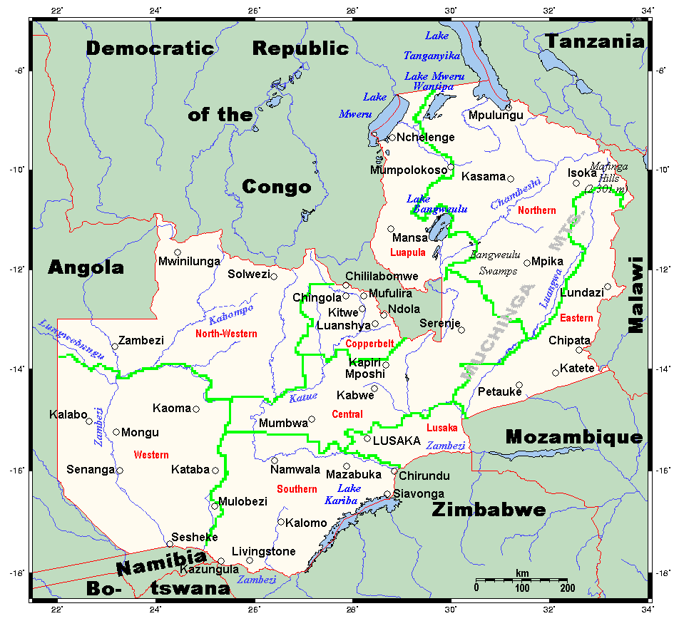
| current | 22:14, 11 December 2006 | | 952 × 871 (54 KB) | wikimediacommons>Electionworld | {{ew|en|Kelisi}} Map of Zambia, major towns, waterways, physical features, etc. This map's source is [http://www.aquarius.geomar.de/omc/make_map.html here], with the uploader's modifications, and the [http://gmt.soest.hawaii.edu/ GMT homepage] says that t |
File usage
The following page uses this file: